The digitized arcs are not always perfect and the nodes need to be adjusted. The node errors are removed by the following procedure;
Arcedit: drawe node on
Arcedit: drawe node error
Arcedit: draw
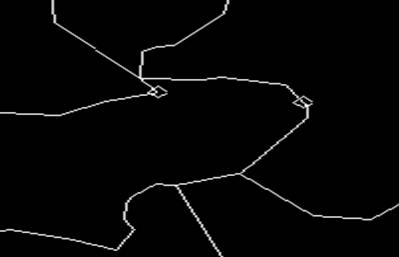
All the nodes with errors will be shown by a square around it. All the nodes without error are shown with a diamond around it. Zoom in to the ones with error and correct the problem with the “move” command.
Problems and solutions
As a novice like me, one is destined to face problems, make mistakes and sometimes even blunders. When I completed the digitization, I opened the coverage in ArcView. Somehow, the identify button was giving me wrong information about each district in India. By clicking one polygon, several other polygons would be selected without even clicking on them. The problem lied in the fact, that the original coverage contained a layer called “Regions” and that’s why by clicking a single polygon, all the polygons in that region were automatically selected.
This problem was solved by adding only the “arcs” from the digitized coverage and not the “regions”. However, in this process, we lost useful information about the polygons (Jay Lee, Pers. Comm.). To correct this problem, A Union of the original “Provincial” boundaries was made with the new coverage and in this way we added the lost information.