3D
Geovisualizations
In one of our labs, we created 3D visualizations of a digital elevation model (DEM)
downloaded from the USGS Map Viewer. The resolution of the DEM is 1/9 arc second
(3m cell size) and is a GeoTIFF, the requisite file type to use in the map viewer. To
create the maps, we used an open-source terrain viewer called 3DEM. I added
a customized color scheme to make the map a little easier to view. Check out the images
of the area in top-down and 3D view.
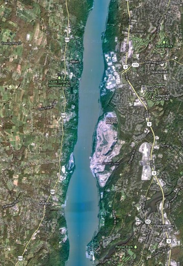
The area shown in these pictures is along the Hudson River just south of Poughkeepsie,
NY, as indicated by the red box on the following map. The satellite image provides
some context to the terrain images. The big grey spot on each of the maps is a large
quarry on the eastern banks of the River.
Also check out this animation over the same area.

Site Maps
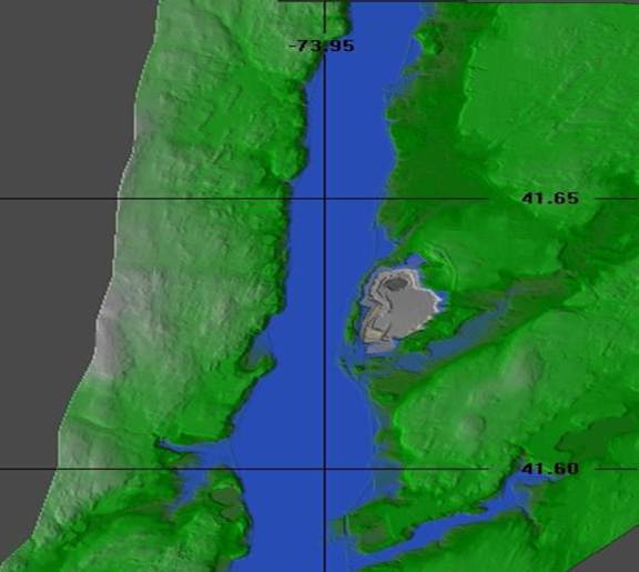 This image is of the Hudson River using 3DEM. Note the quarry
on the eastern side.
This image is of the Hudson River using 3DEM. Note the quarry
on the eastern side.
 This image is a 3D view of a portion of the terrain file. The quarry is
clearly evident.
This image is a 3D view of a portion of the terrain file. The quarry is
clearly evident.